Looking for one of the best hikes in the Northeast? Look no further. The Mount Katahdin Knife Edge trail is a bucket list hike you’ll tell stories about for years and years to come. Over the course of 8 strenuous miles and 4,000 feet of elevation gain, you’ll reach the summit of Mount Katahdin and scale the iconic Knife Edge ridge.
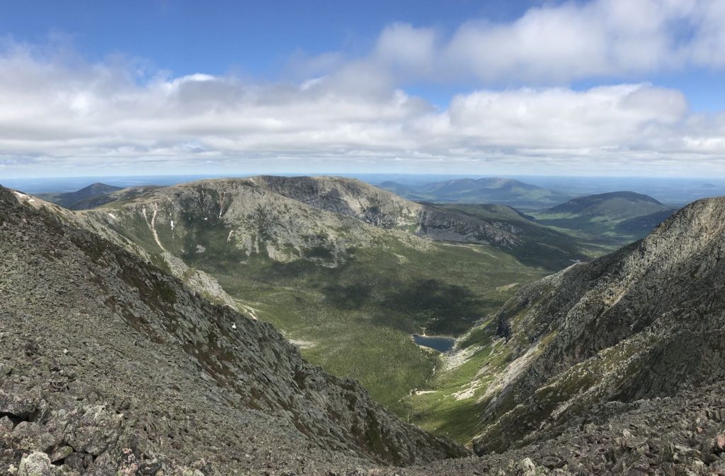
While there are multiple entry points to begin the Mount Katahdin Knife Edge trail, we’ll be covering the most common route known as the Chimney Pond, Cathedral, Knife Edge, Helon Taylor loop. You can view the detailed trail here on All Trails.
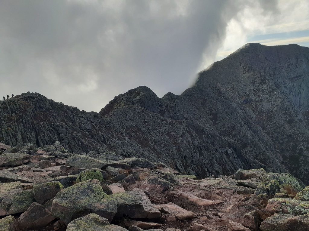
Hiking the Mount Katahdin Knife Edge trail is worth every ounce of pain, but its level of difficulty cannot be taken lightly. The Knife Edge ridge should especially only be hiked by those capable and prepared. It also should never be attempted during adverse weather. Even on a clear and sunny day, high winds can create danger when scaling the Knife Edge ridge. Although this is considered a hiking trail, there are certain areas, especially on the Knife Edge ridge, that are better described as a technical climb. For a better idea, and to see exactly what you’re up against, check out the video below.
Frequently Asked Questions
How long does it take to hike Mount Katahdin Knife Edge?
Anywhere from 8-12 hours. Completion time depends on your level of experience and fitness. But make no mistake, this is a full day hike. We recommend packing a full lunch and 3-4 liters of water per person. Be sure to start early and plan to finish an hour or two before it gets dark, just in case it takes you longer than expected. Being stuck out on the trail with little to no light should be avoided.
How long is the rock scramble of Knife Edge?
The Knife Edge trail is roughly one mile in length and will require you to traverse the ridge slowly. You’ll likely complete the majority of this section on your hands and knees to increase stability on the ridge. Although this section is only one mile, it can easily take two hours to complete safely.
How hard is it to climb Mount Katahdin?
On a scale of 1 to 10, our official score is a solid 8.5. The Mount Katahdin Knife Edge trail will test you both physically and mentally. Training for a big hike is always recommended, check out our hiking workout plan to get you ready.
Hiking Route:
Follow Chimney Pond Trail (3.1 miles) to the Cathedral Trail (1 mile) which will lead you to the Baxter Peak summit. From the summit, take the Knife Edge Trail (1.1 miles) to the Helon Taylor trail (2.8 miles) to the Chimney Pond trail back to the Roaring Brook campground and parking lot.
First, Some Quick History
Mount Katahdin was originally named by the indigenous people of the Penobscot Nation. The word Katahdin translates to “The Greatest Mountain,” and was said to be home to the thunder god, Pamola. Legend has it, Pamola guarded the mountain and forbade anyone from climbing to the summit. Mount Katahdin is Maine’s highest peak, and its unmistakable silhouette can be seen from miles away.
Mount Katahdin Campgrounds
Baxter State Park offers 10 official campgrounds to choose from. The summer camping season is tentatively scheduled from May 15 to Oct. 15 every year, weather permitting. If you’re planning an early or late season visit, it is best to check first with Park Headquarters. Camping fees vary depending on the site. You can find all of that information on the Baxter State Park website.
The closest campground to Mount Katahdin is Roaring Brook
Roaring Brook Campground is one of the busiest campgrounds in Baxter State Park, primarily because it’s just a couple hundred feet from the Mount Katahdin Knife Edge trailhead. It offers 9 lean-tos, 10 tent sites, and one 10-person bunkhouse. The Bear Brook group area is located about 2 miles away, with three group sites holding 14 people per site.
Day-use parking is also available at Roaring Brook Campground
There’s the Bear Brook group area, which is located about 2 miles away from Roaring Brook. Bear Brook consists of three group sites holding 14 people per site.
Backcountry campsites are also available near and associated with Roaring Brook: Martin Ponds, North Katahdin Lake, and South Katahdin Lake. Each of these sites offers a 6-person lean-to and canoe. You can find all of this information on the Roaring Brook Campground Map.
Mount Katahdin Knife Edge Trailhead: Getting Started
Right next to the Roaring Brook Campground lies the Chimney Pond trailhead, where you’ll begin your ascent to Mount Katahdin and the Knife Edge Trail. Like my most hikes, it’s always a good idea to get an early start and beat the crowds, especially if you’re hiking during peak season.
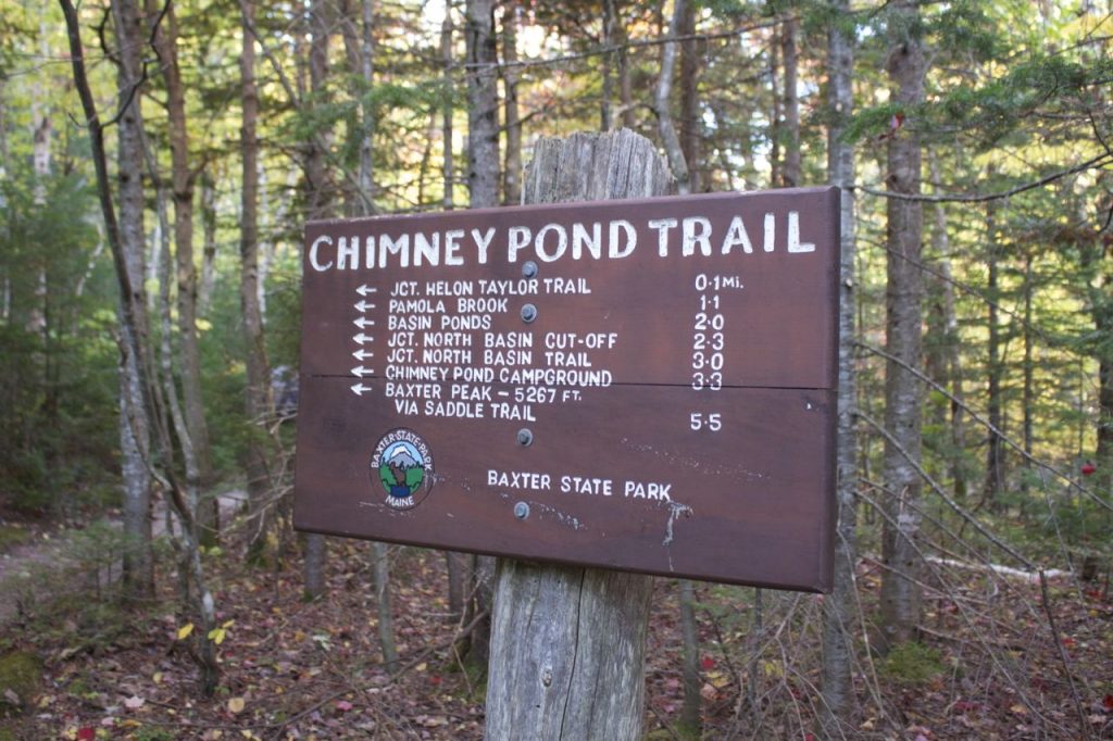
You’ll begin the trail hiking alongside Roaring Brook with little to no elevation gain. A few miles in, you’ll reach Basin Pond and cross paths with the North Basin trail. From here, you’ll have about approximately one more mile until you reach the Chimney Pond campground.
Once you’ve reached Chimney Pond you’ll be staring up at Mount Katahdin and the Knife Edge trail. As you continue up the trail you’ll see three distinguished rock formations known as the “cathedrals” on the right ridge. This is the most common and shortest route to the summit.
Cathedral Trail to Mount Katahdin
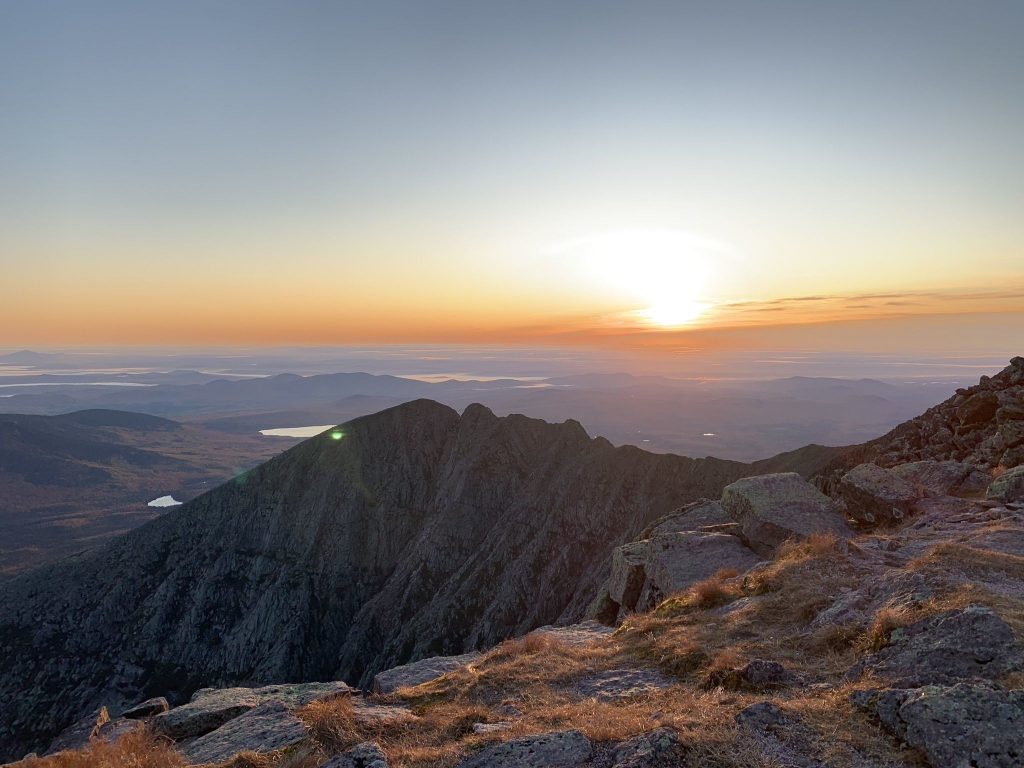
The Cathedral trail begins by the ranger cabin just before the pond, can’t miss it. This is where the hike starts to get interesting. The next mile of the hike is a steep rock scramble as you climb above the tree line. During this short but strenuous stretch, you’ll climb over 2,000 feet of elevation.
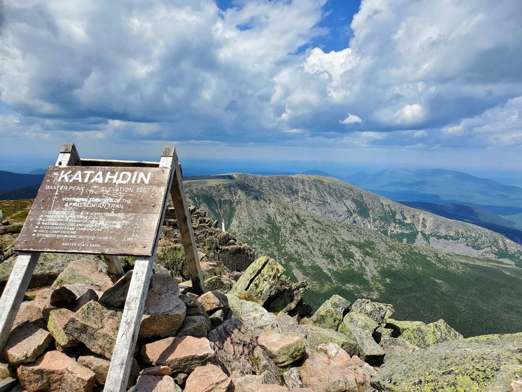
Once you’ve reached the top of the third and final cathedral, you’ll continue to the junction with the Saddle trail. Once you reach the junction, the Katahdin summit is a short hike away. You’ll approach a large rock cairn and the iconic Katahdin sign. Once here, you’ve officially reached the northern terminus of the Appalachian Trail. Be sure to take a moment to savor the view, take a picture with the Katahdin sign, and prepare for the Knife Edge trail.
The Knife Edge Ridge
The Mount Katahdin Knife Edge trail begins right near the summit cairn. On both sides of the Knife Edge trail lies treacherous slopes of rocky debris. The first quarter-mile of the Knife Edge trail leads to Mount Katahdin’s south peak. From here, the trail slowly descends as the ridge bends around the basin.
But you’re not done yet. The second half of the Mount Katahdin Knife Edge trail gets even more demanding. As you continue through the ridge, you’ll reach several vertical ascents and sharp descents as you climb Chimney Peak and to the top of Pamola Peak.
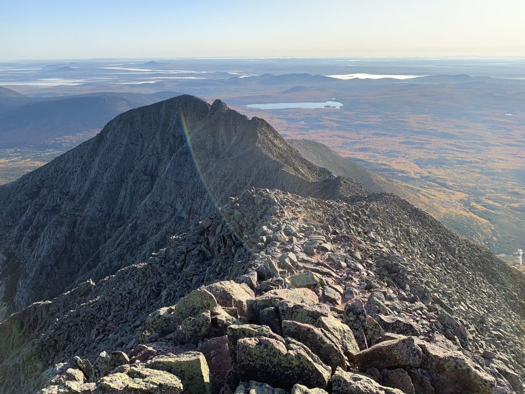
The end is near as you begin to descend the Helon Taylor trail towards the tree line. You’ll continue steadily downhill for a few miles where the trail will eventually level out once you reach the forest. After hours of vigorous hiking, the Mount Katahdin Knife Edge trail will conclude at Chimney Pond and lead you back to the Roaring Brook campground and parking area.
Final Thoughts
Completing this hike will take determination and resolve. You should not attempt the Mount Katahdin Knife Edge hike unless you’re confident in your ability as a hiker. But, if you’re up for the challenge, I promise it will be a hike you’ll never forget.

